stephen July 27th, 2009
Saturday 25 July was a fine sunny day – and we had a lot of helpers planting along the boardwalk from Megacentre south to the new wetland.
Thanks to everyone, including our volunteers, Melissa and Metrowater for the plants.
Next planting day is
15 August, 10am – on the creekside at the end of Fergusson Ave.
ALL WELCOME.

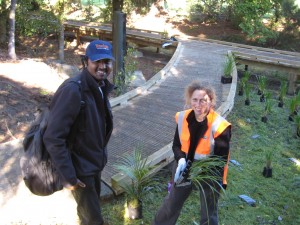
Melissa Marler, our co-ordinator - is laying out plants and welcoming Gogul Muthu

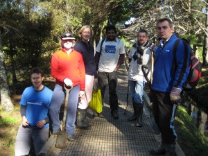
Nick Goldwater, Freddie Sherwin, Jane Chatterly, Gogul Muthu, John Smith and Trevor Sherwin after putting the last few plants in the ground
Like this:
Like Loading...
stephen July 23rd, 2009
STEPS opposed this plan change on a number of grounds as attached. A summary of all submissions is now available on the council site above. Anyone can now make a further submission in support of STEPS or other submissions until 31 July 2009.
STEPS submission can be read here.
Like this:
Like Loading...
stephen July 23rd, 2009
The large aquifer underlying Meola and Oakley Catchments has at least three names as above. The different names make clear the large extent of the clean water – a “buried treasure” of Auckland City.
As part of their Quarrying operation, Winstones are pumping out water from the top of the aquifer under Meola Creek – and into Manukau Harbour through the stormwater system. STEPS believes this has a direct impact on Meola Creek’s low base flow.
The report prepared for Winstone Aggregates by Tonkin and Taylor Ltd 8 July 2008 p1 “At its current depth (quarry base at RL34, with quarry rim at RL60-RL80 approx), resources are being extracted from below regional groundwater level. Groundwater within the quarry is depressed to below the quarry floor by pumping from a well within the quarry property.“

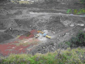
2009 photo - water is normally maintained at 34 RSL

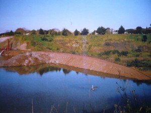
1998 photo - water is approx 2 metres above water table (56 RSL)
These pictures give some idea of the amount of water which is removed in order to achieve this.
In May 2009 Winstones applied for a resource consent to fill the hole with “clean fill”. The Three Kings United group (whose link is on this site) have monitored and researched this situation for many years. They are asking for truck movements to be limited, and for the pit to be lined with impermeable surface to prevent leaching into the aquifer.
Like this:
Like Loading...