Archive for the 'Meola Creek Waititiko' Category

STEPS Submissions on Auckland Plan Change 120

September 25th, 2026

STEPS has been working with several groups across Meola catchment for months, including: Cabbage Tree Swamp Incorporated (CTSI), Character Coalition, South Epsom -Three Kings Planning Group, Balmoral Residents Association, Eden Kingsland Society, neighbourhood groups around Morningside, Haverstock-Kitchener Roads, and other locations.

  • Meola is the largest catchment on the Auckland isthmus. – 15.6 square kilometres.
  • “Albert-Eden (AELB) is the most urbanised local board in the Auckland Region.”
  • AELB has one of the lowest number of parks per capita.
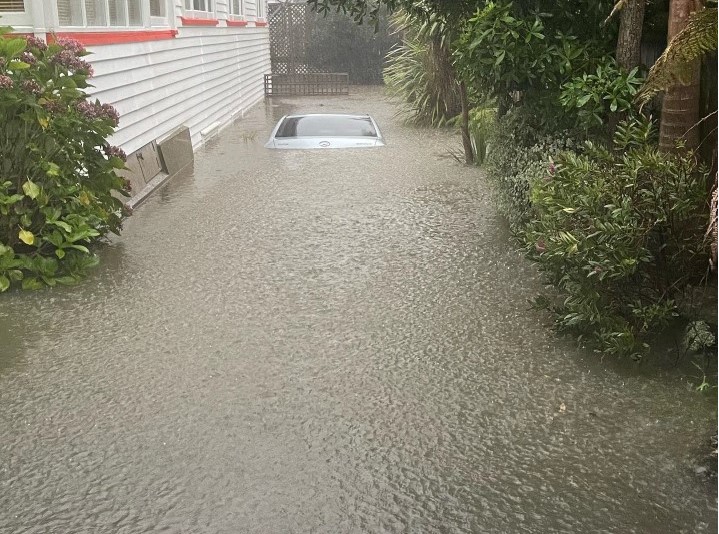
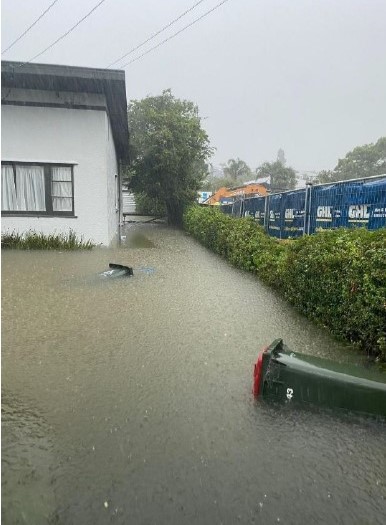
  • Meola Catchment is a flood prone catchment, with far less infrastructure than most other Auckland urban catchments. It was one of the most damaged catchments in the 2023 floods.
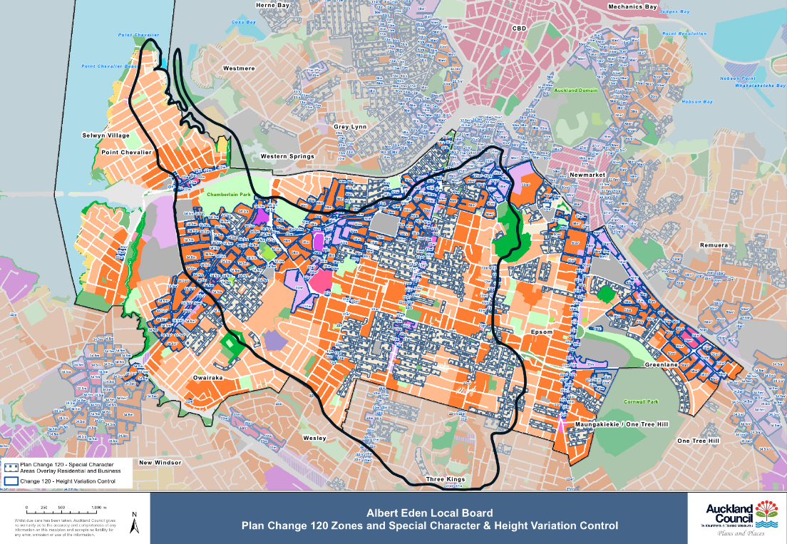
Half of AELB’s land lies in Meola Catchment.

We have all met with Councillors, AELB, and Council Officers but have heard no plans for stormwater. After we all presented to AELB, the board recommended a Meola Catchment Management Plan when reporting back to Auckland Council.
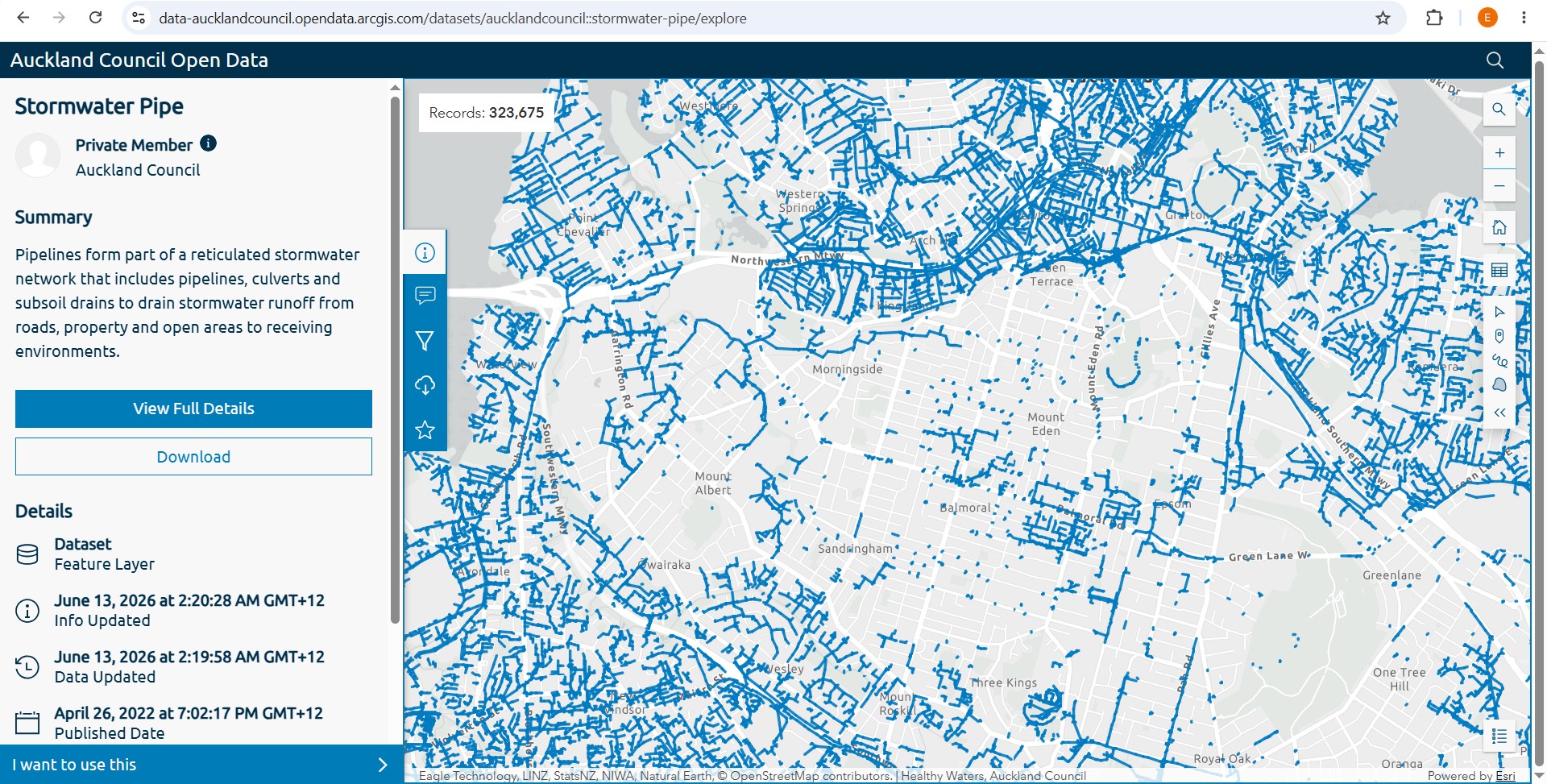
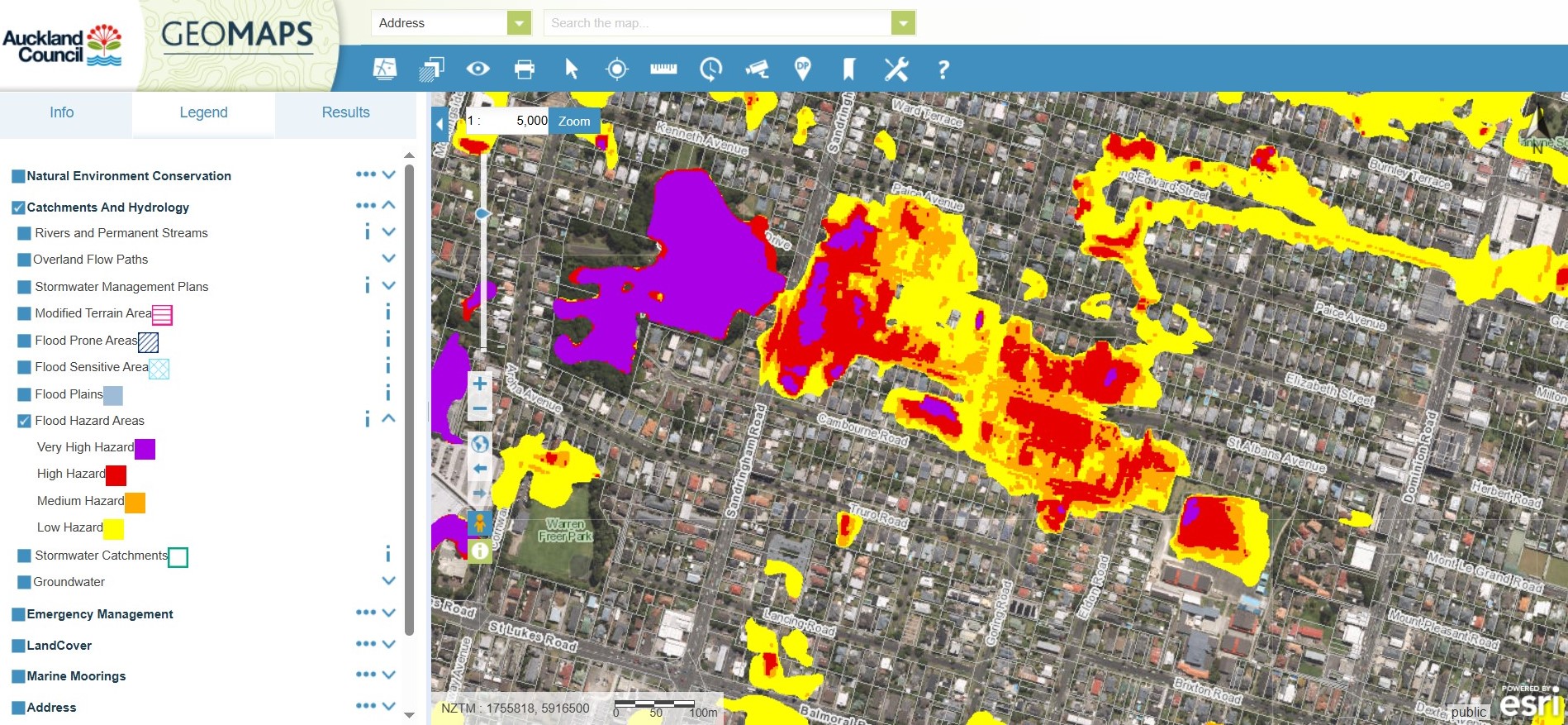
The blue networks are stormwater pipes. Meola catchment is centre left in grey, with few pipes around either Owairaka or Maungawhau.
East of Gribblehirst Park are properties showing as “high hazard” and “very high hazard”

Plan Change 120 will approximately double the potential number of new residences in Meola catchment, since Government Legislation mandated intensification around our four railway stations . Maungawhau, Kingsland, Morningside and Baldwin.

STEPS is seeking some “Making Space for Water Blue Green Networks” which have been built elsewhere since the 2023 floods. Meola Creek needs increased carrying capacity for floods, but once again Meola dropped off Council’s Blue-Green funding list.

We also ask that prior to intensification, a “Whole of Meola Catchment Management Plan” is developed, and a flood-mitigation strategy implemented. We propose that PC 120 zoning does not preclude daylighting of Meola Creek, and would encourage Council to proceed with it as outlined here.

Read STEPS public submission by downloading September 2026 here: and December 2025 here.
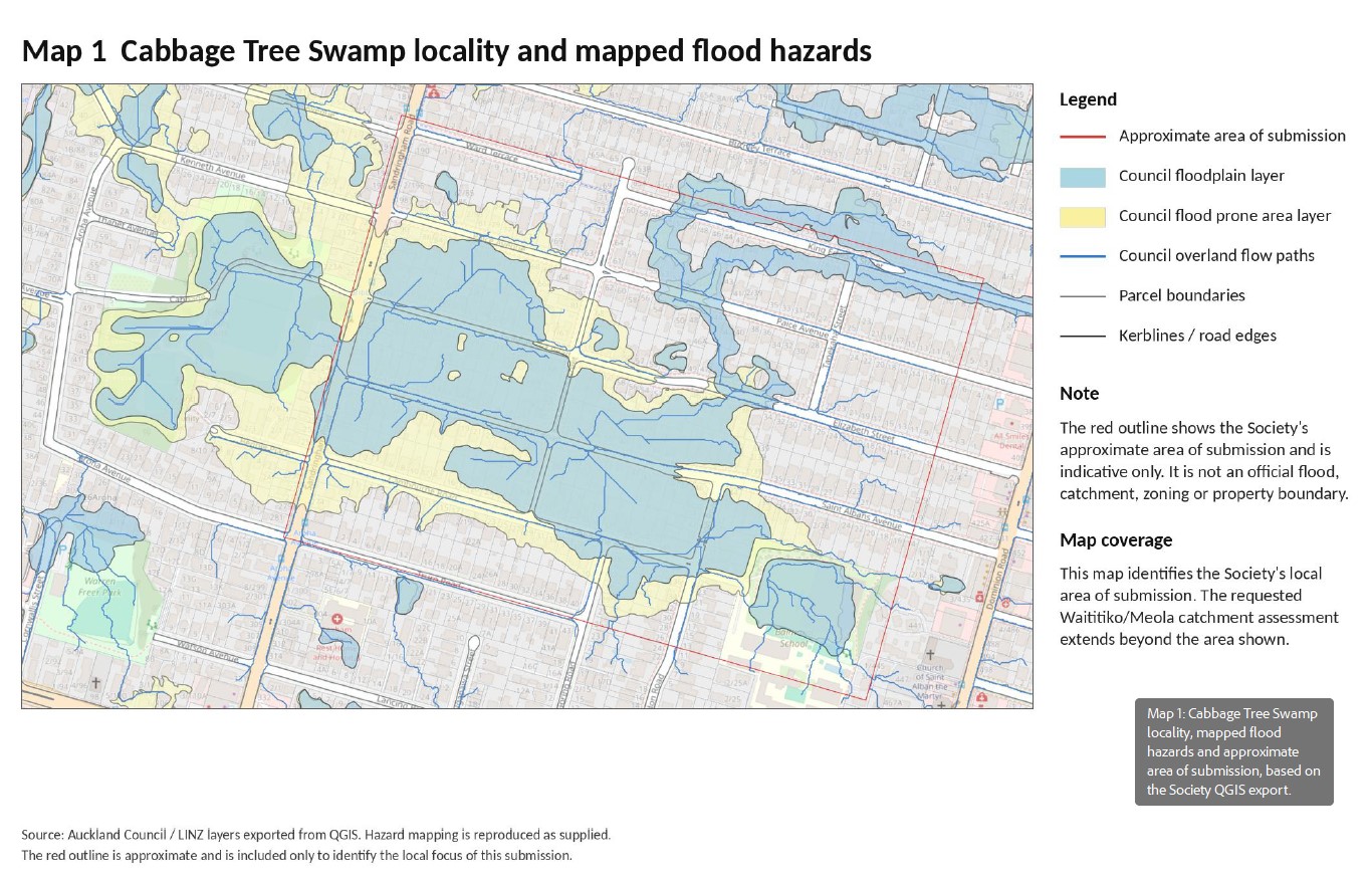
Submission to Plan Change 120 from Cabbage Tree Swamp Inc.

September 25th, 2026

STEPS has been working with Cabbage Tree Swamp Incorporated. Stormwater from the Gribblehirst area reaches Meola Creek at Lyon Ave, contributing to large overflows at times. CTSI have shared their additional PC 120 submission, 24 September 2026, written with the help of a stormwater engineer.

These photos show floods at 2023 Anniversary Weekend.

Find their September 2026 submission here. CTSI PC120 Additional Submission 24-09-2026

Proposed Waitītiko path, public space and daylighting opportunity

June 7th, 2024

Tāmaki Makaurau has an opportunity for an ara or path along a potentially daylighted section of Waitītiko from source puna (springs) on Ōwairaka Mt Albert foothills to the upper creek at Ahurangi, site of Te Kura Kaupapa Maori o Nga Maungarongo.

For many years, STEPS has advocated improvement on a Mountain to Sea Walkway – from Ōwairaka to Te Tokaroa (Meola Reef).
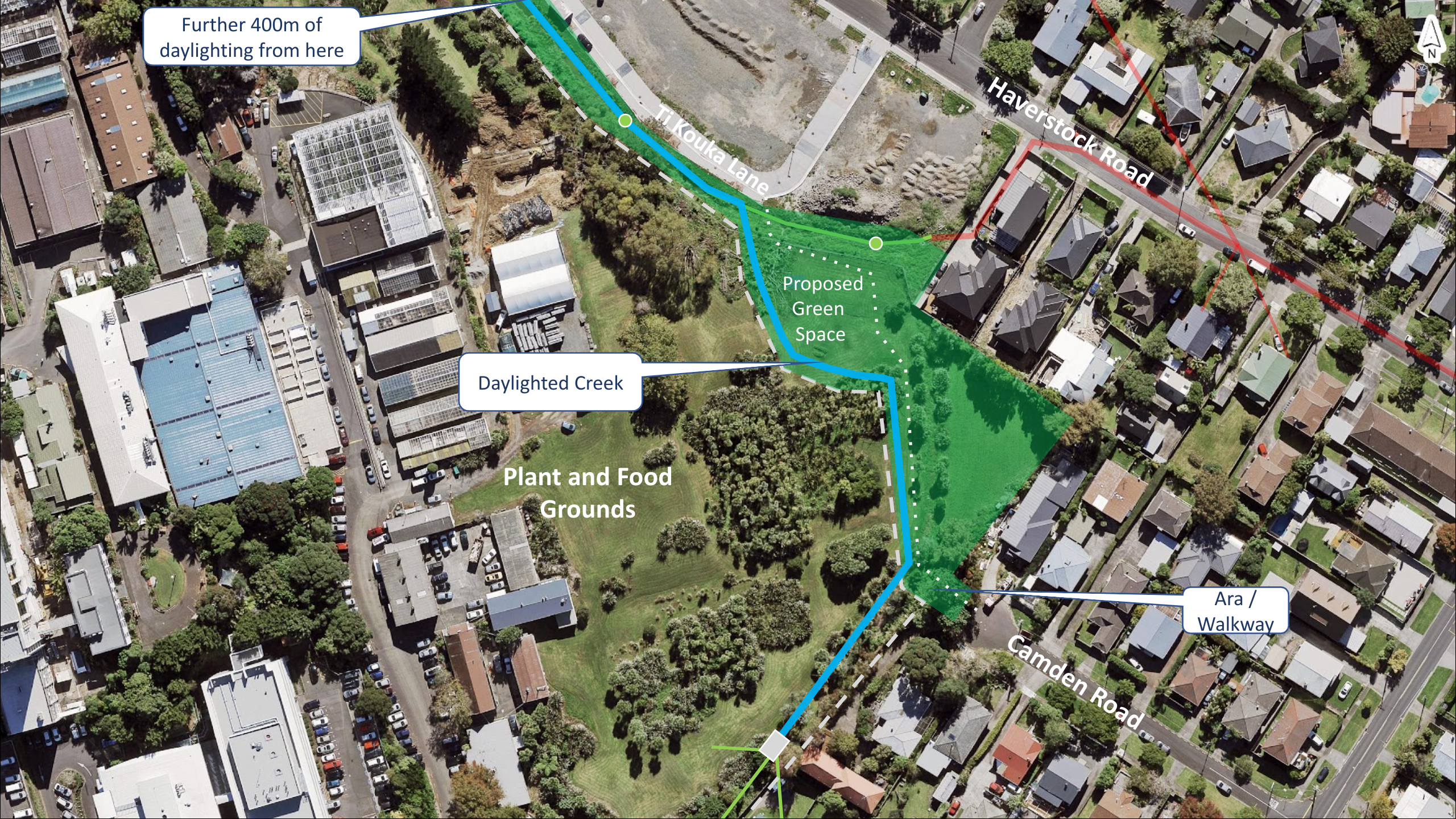
More recently a plan for this linking ara and daylighting 500 meters of creek on the Mountain to Sea Walkway was proposed. This has been enabled by the work of the Watercare Central Interceptor (CI) project at Haverstock Road. Led by Andrew (Mac) Mackintosh, it has been presented to Auckland Council Healthy Waters, Albert Eden Local Board, Watercare, Plant and Food, STEPS Members AGM, and other groups.

The location below Plant and Food Crown Research Institute (CRI), and behind Haverstock Rd forms a vital link in Waitītiko-Meola Creek Mountain to Sea Walkway, freeing the source of the awa or creek, and making it available to rate payers and tax payers. All the land is owned by the Crown. Watercare is a Council Controlled Organisation, and part of Auckland Council. Watercare have opened up the link from Haverstock Road right of way, through to Camden Road for the first time in fifty years, for their trucks to go through it.

As Watercare complete community infrastructure work on Crown Land, both Watercare and the CRI have an immutable plan to again close the potential community link to Waitītiko-Meola Creek behind high security fences. Why would our governing bodies continue on a direction of concrete and security fences in this era when in most parts of the world Sustainability is key, and streams form a vital part of our natural world for people to connect to? They claim that $1-2 Billion will improve water quality and reduce overflows – so surely providing this short path connecting to the stream is one way of demonstrating the value of work out of sight, 50 meters below the earth.

This specific situation also provides a chance to daylight 500 meters of the creek with very little physical work needing to be done, and therefore at very low cost.

STEPS continues to ask Auckland Council, AELB, Watercare, and Plant and Food to open public green space, recover a lost section of awa, and to create some more community walking space.

Here is the full proposal

We ask for public support

  • come on the STEPS heritage walk – to be advertised for late September 2024…
  • talk to your local Board Member, or Councillors Julie Feary and Christine Fletcher.

Join our facebook page @STEPSNZ now

Next »