St Lukes Environmental Protection SocietyProtecting Meola Creek's environs since 2005
St Lukes Environmental Protection Society (STEPS) was incorporated in 2005. Its purpose is to protect and enhance the environment and amenities in the St Lukes area. Read more ...
STEPS was delighted to hear a presentation by long time member Dr. Sandra Anderson of Auckland University. Sandra presented 10 years of research-based evidence to show us the key aspects of a successful restoration. See “The cost of ‘second-rate’ for native plant communities” below.
Making Space for Water is a long-term commitment to reducing flood risk and building resilience by fast-tracking infrastructure upgrades, alongside advanced technology, smarter planning and community partnerships.
Here is the first newsletter from Auckland Council’s “Making Space for Water” initiative.
Please subscribe Here to the newsletter and encourage your community to do the same, to find out what’s happening, how to make better decisions about flood risk, and how to get involved.
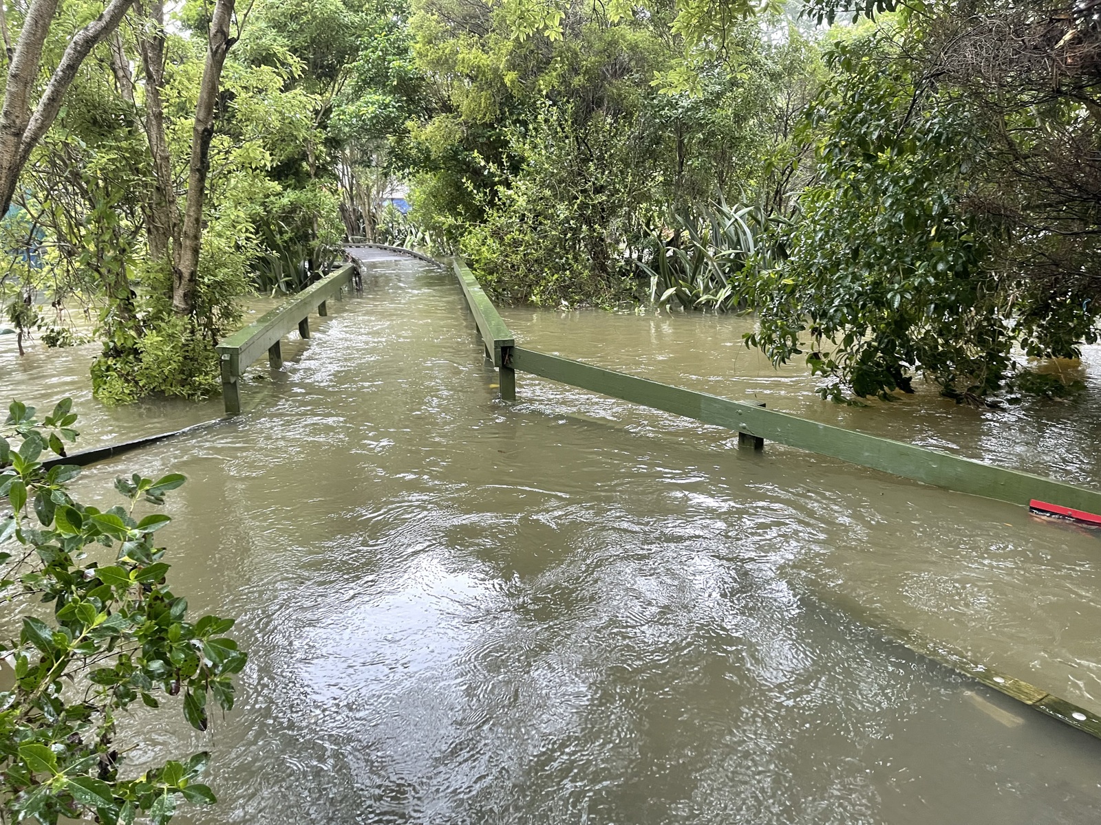
Above is a photo of Waitiitiko Meola Creek in flood, 1 February 2023. (Photo David Rees).
On the foothills of Õwairaka Mt Albert where the main source puna spring for Waitītiko lies, Whaea Dianne Pomare told us of a local wetland named Ahurangi. The name is now used for the piped awa which runs from below Camden Rd, to Kerr-Taylor Reserve. It is beside Te Kura Kaupapa o Ngā Maungarongo, on Haverstock Rd.
Ben Goodwin, a wetland ecologist has created this view of Ahurangi for us.
Ahurangi was a wetland behind and below what is now NZ Institute for Bioeconomy Science. It was sandwiched between the eastern toe of the Te Ahi Ka a Raka tuff ring and the edge of the Te Tatua a Riukiuta lava field. I guess it was formed c.28,500 years ago, when Te Tatua lava blocked an earlier gully which cut through the area. The ouflow of this swamp constricted down into a narrow channel (Waitītiko) as it flowed between the Te Ahi Ka a Raka and Te Tatua a Riukiuta lava fields. ‘ There also may have been forest in this area, at least until the 1840’s.
This 1842 survey map shows an area which could be interpreted as forest, but it could represent something else. If it was forest, it was growing on the lower slope of the tuff ring, including the area where plant & food is now. Any forest in this area would have been “WF7.2” forest (under the definition in Singers et al, 2017), but it wasn’t rock forest, as there was no basalt present, only tuff and associated weathered volcanic soil (demonstrating a limitation of the WF7.2 ecosystem). On the 1842 map, I’ve drawn the extent of possible forest on (in green) and wetland/creek (in red). I’ve overlaid a contemporary satellite picture in there to give you some bearings.
 Loading…