Liz March 16th, 2017
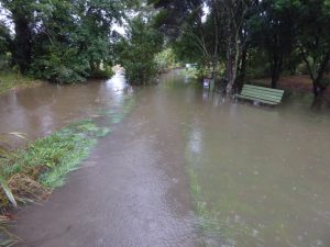
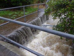
Flooding at entrance to Roy Clements Treeway
Meola Creek floods about 80 times a year. According to Mt Albert Grammar weather station 191mm of rain fell from Friday afternoon to Sunday afternoon, while 72mm of it fell between 10:30am and 12:30pm Sunday… that’s nearly a month’s worth of rain in two hours!
See some more dramatic photos of Meola Creek last weekend in our photo gallery on this site.
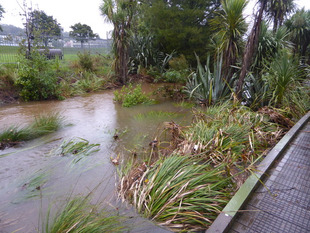
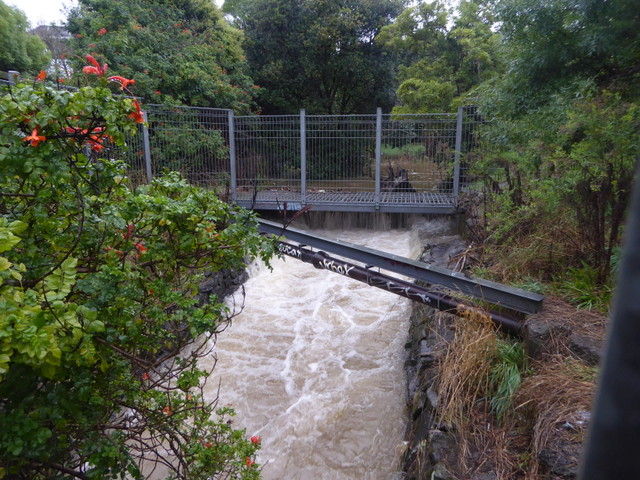
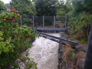
Our photos show Meola Creek filled to the brim, spilling over into the wetland, the flood plain and lapping the 90cm high boardwalk and bridges. At times the bridges and parts of the walkway were covered. The sign near Megacentre and the sign within the spillway at Lyon Ave/ Edendale branch sewer can be seen partly covered as an indicator of height.

Red silted storm water with MAGS playing fields in background.
The water was bright red from all the silt and soil, especially up at Haverstock outfall. Usually it is grey from a mix of oily road runoff, human waste, zinc and copper from roofs, metal from car brakes and general rubbish. Nearly 50% of water comes from roads alone. There is a Government Special Housing Area building about 50 houses on top of the largest sewer outfall at 96 Haverstock Rd. It is reasonable to assume that the red soil in this weekend’s floods come mainly from there, as that area is the original land source of the creek.
While it is expected that by about 2027 the planned Auckland Central Interceptor project will reduce the number of floods in Meola to perhaps 1 per month, large flood events like this one will still occur. It is good that house inundation has not been reported in our vicinity for this particular event.
Given the Auckland unitary plan for intensification of Mt Albert which has little stormwater infrastructure and has historically relied on natural soakage it seems reasonable to assume that storm water volumes will grow.
Haverstock Rd outfall
What could improve this situation?
- Auckland Council “Healthy Waters” (formerly stormwater team) can separate the combined sewers in both the Haverstock Rd area and in Pt Chevalier to prevent stormwater mixing with raw sewage and overflowing the sewers
- Auckland Transport can use roading and footpath surfaces which are more permeable and allow the water to drain naturally into the aquifer, rather than being diverted to creeks as part of the storm water mix -Permeable pavement
- Auckland planners can check what consideration they have given to flooding with plans for intensification in areas like Mt Albert which have limited stormwater infrastructure and rely on natural soakage
- Homeowners can reduce impermeable concrete in back yards and use a permeable surface to manage their own storm water on site and recharge the aquifer. Here is an example of permeable concrete
Stormwater entering pipe at Alberton Avenue
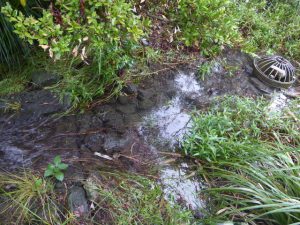
Afterwards, STEPS wetland discharged clean water for three weeks so far

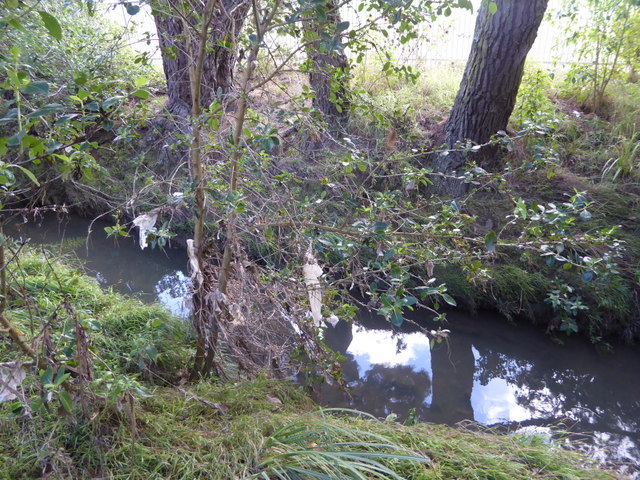
Plastic and toilet paper remain in trees 1m above the bank for more than 3 weeks also
See also Links:
http://www.stuff.co.nz/national/90381470/tasman-tempest-aucklands-wettest-march-day-in-58-years
http://home.nzcity.co.nz/news/article.aspx?id=244184
Our flood photo gallery is at:
Flood – March 2017
Like this:
Like Loading...